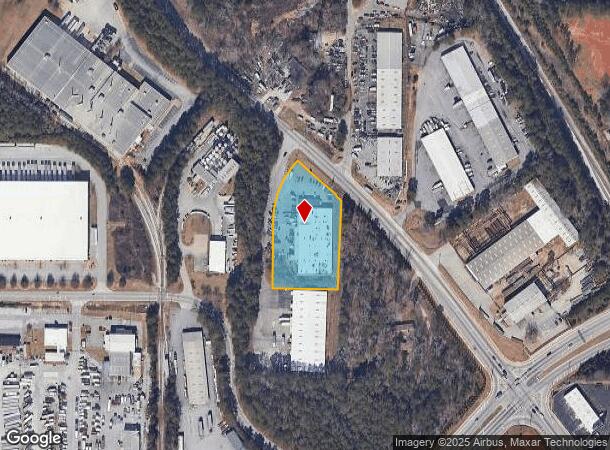
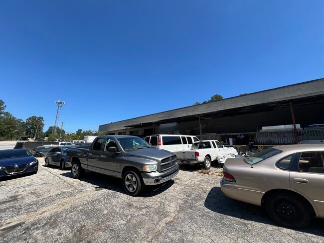
Property Record
2435 Stone Mountain Lithonia Rd, Lithonia, GA 30058
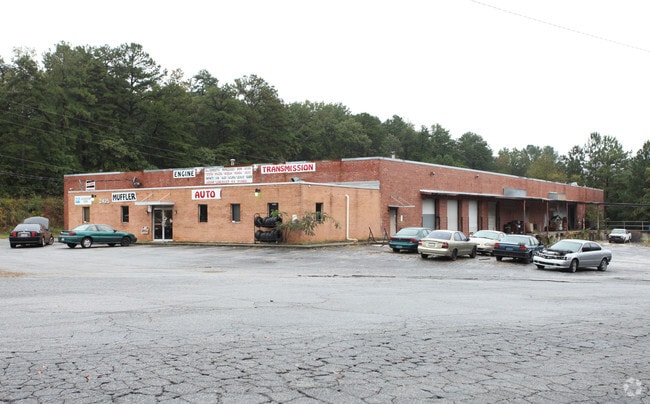
This Property Is For Sale
Current Lease Availabilities
NEARBY LISTINGS FOR SALE OR LEASE
Property Detail
2435 Stone Mountain Lithonia Rd
16-124-02-007
DeKalb
Warehouse
Georgia
X
7
13247C0080D
1.70 AC
2025
Snapfinger
2025
Atlanta
023313
Atlanta-Sandy Springs-Roswell, GA
25,990 SF
DEMOGRAPHICS near 2435 Stone Mountain Lithonia Rd
1 Mile
3 Mile
5 Mile
2024 Total Population
3,686
60,843
151,461
2029 Population
3,771
60,650
150,914
Pop Growth 2024-2029
+ 2.31%
(0.32%)
(0.36%)
Average Age
38
38
38
2024 Total Households
1,327
21,862
55,163
HH Growth 2024-2029
+ 2.41%
(0.41%)
(0.49%)
Median Household Inc
$61,404
$62,676
$63,976
Avg Household Size
2.70
2.70
2.70
2024 Avg HH Vehicles
2.00
2.00
2.00
Median Home Value
$147,596
$184,614
$199,837
Median Year Built
1995
1994
1990
Nearby Places
Map Layers
Map Styles
 Street
 Aerial
- Restaurants
- Banks
- Shops
- Fitness
- Groceries
PUBLIC TRANSPORTATION
AIRPORT
Hartsfield - Jackson Atlanta International
DRIVE
WALK
Distance
Hartsfield - Jackson Atlanta International
34 min
23.0 mi
Freight Ports
Georgia Ports - Savannah
DRIVE
WALK
Distance
Georgia Ports - Savannah
284 min
243.3 mi
Nearby Properties
Address
Land Use
TOTAL SIZE
Lot Size
Zoning
Address
Land Use
TOTAL SIZE
Lot Size
Zoning
614,505 SF
97.30 AC
Address
Land Use
TOTAL SIZE
Lot Size
Zoning
208,447 SF
26.56 AC
RM100
Address
Land Use
TOTAL SIZE
Lot Size
Zoning
764,622 SF
48.38 AC
M
Address
Land Use
TOTAL SIZE
Lot Size
Zoning
274,631 SF
25.67 AC
RM100
Address
Land Use
TOTAL SIZE
Lot Size
Zoning
271,666 SF
33.72 AC
RM100
Address
Land Use
TOTAL SIZE
Lot Size
Zoning
235,521 SF
15.36 AC
RM75
Address
Land Use
TOTAL SIZE
Lot Size
Zoning
224,155 SF
22.58 AC
X
Address
Land Use
TOTAL SIZE
Lot Size
Zoning
118,007 SF
14.31 AC
Address
Land Use
TOTAL SIZE
Lot Size
Zoning
314,474 SF
24.04 AC
RM75
Address
Land Use
TOTAL SIZE
Lot Size
Zoning
405,288 SF
28.89 AC
C1
Address
Land Use
TOTAL SIZE
Lot Size
Zoning
81,537 SF
9.27 AC
C1
Address
Land Use
TOTAL SIZE
Lot Size
Zoning
189,472 SF
30.90 AC
RM100
Address
Land Use
TOTAL SIZE
Lot Size
Zoning
1,810 SF
234.33 AC
RA8
Address
Land Use
TOTAL SIZE
Lot Size
Zoning
267,899 SF
47.90 AC
X
Address
Land Use
TOTAL SIZE
Lot Size
Zoning
283,988 SF
29 AC
RM100
Address
Land Use
TOTAL SIZE
Lot Size
Zoning
198,140 SF
18 AC
RM100
Address
Land Use
TOTAL SIZE
Lot Size
Zoning
218,152 SF
18.80 AC
RM100
Address
Land Use
TOTAL SIZE
Lot Size
Zoning
36,951 SF
8 AC
Address
Land Use
TOTAL SIZE
Lot Size
Zoning
138,876 SF
20 AC
RM100
Address
Land Use
TOTAL SIZE
Lot Size
Zoning
7,384 SF
15.80 AC
M
Address
Land Use
TOTAL SIZE
Lot Size
Zoning
215,422 SF
33.84 AC
M
Address
Land Use
TOTAL SIZE
Lot Size
Zoning
227,648 SF
14.56 AC
X
Address
Land Use
TOTAL SIZE
Lot Size
Zoning
72,755 SF
5.17 AC
C1
Address
Land Use
TOTAL SIZE
Lot Size
Zoning
365,757 SF
31.36 AC
RM100
Address
Land Use
TOTAL SIZE
Lot Size
Zoning
32,000 SF
6.86 AC
X
Address
Land Use
TOTAL SIZE
Lot Size
Zoning
18,099 SF
1,412.45 AC
M2
Address
Land Use
TOTAL SIZE
Lot Size
Zoning
116,473 SF
15.63 AC
C-1
Address
Land Use
TOTAL SIZE
Lot Size
Zoning
207,446 SF
12.21 AC
M
Address
Land Use
TOTAL SIZE
Lot Size
Zoning
48,531 SF
10.01 AC
C1
Address
Land Use
TOTAL SIZE
Lot Size
Zoning
92,416 SF
5.48 AC
OD
The World's #1 Commercial Real Estate Marketplace
Connect with us
© 2026 CoStar Group
The information above has been obtained from sources believed reliable. While we do not doubt its accuracy we have not verified it and make no guarantee, warranty or representation about it. It is your responsibility to independently confirm its accuracy and completeness. Any projections, opinions, assumptions, or estimates used are for example only and do not represent the current or future performance of the property. The value of this transaction to you depends on tax and other factors which should be evaluated by your tax, financial, and legal advisors. You and your advisors should conduct a careful, independent investigation of the property to determine to your satisfaction the suitability of the property for your needs.